Poster abstracts from the 2020 Polar Technology Conference are provided below. Poster files will be added to this page following the conference.
Science Drivers
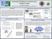
Exchange Processes in the Ross Gyre, Southern Ocean
The Antarctic system is highly sensitive to increasing global temperatures, and the ocean component is crucial in understanding the projections of the melt rate of the Antarctic Ice Shelves and global sea-level rise. Southern Ocean gyres are an intermediate step in the connection of the warm Southern Ocean with the Antarctic Ice Shelves. Recent fine‐scale observations in the Ross Gyre of the Southern Ocean revealed a layered structure within the pycnocline underlying the surface mixed layer. These layers (3-5 m in depth) are formed by small-scale mixing processes involving both turbulence and double diffusion. Background changes in stratification and enhanced or suppressed double-diffusive heat fluxes can alter sea-ice growth rates and the meridional propagation of the warm waters towards the Antarctic shelves. High resolution vertical and time sampling are necessary to provide year-round in-situ observations with fine-scale/microstructure vertical resolution. An array of moorings across the boundaries of the Ross Gyre would help pinpoint the main exchange processes (such as eddy field, intrusions) that set vertical background stratification. In addition, a set of autonomous floats could provide insight on small scale processes and potential sea-ice-ocean feedback loops.
Light Transmittance and Potential Solar Heating of the Ocean Water Column Following Record Low Sea Ice Extents Across the Distributed Biological Observatory in the Pacific Arctic Region
Record lows in seasonal sea ice cover in the northern Bering Sea and Chukchi Seas have been observed over the past several years, which have had important cascading impacts on the physical, biological, and biogeochemical state of the overall marine environment throughout the region. Measurements of the transmittance of solar radiation through the ocean water column is one of the critical elements for understanding the potential implications of these recent shifts in sea ice, including impacts on primary production, damaging effects of UV radiation on phytoplankton, photodegradation of dissolved organic matter, and upper ocean heating. We present observations of downwelling irradiance and upwelling radiance profiles in the top ~30–50 meters of ocean waters, collected at 36 discrete stations across the northern Bering and Chukchi Seas. Profiles were collected during July 2018 and 2019 as part of the Distributed Biological Observatory (DBO) program onboard the CCGS Sir Wilfrid Laurier, and represent first observations of the optical consequences of these extremely low ice years. Continued monitoring at these DBO sites will be crucial for understanding changes in the optical and underwater light field as the duration of the open water season continues to lengthen with declining seasonal sea ice cover.
Principles for Conducting Research in the Arctic: Connecting Scientists and Communities through Accountable and Respectful Research Practices
Studies of the Arctic environment are often done in or near Indigenous lands, and researchers working there have a responsibility to respect local culture and knowledge and advance stewardship of the Arctic environment. In November 2018, the U.S. Interagency Arctic Research Policy Committee (IARPC) approved new guidelines for the conduct of research to better align them with U.S. Arctic policy, to incorporate the latest advances in research methods, and to reflect expanded research efforts and disciplinary breadth in a rapidly changing Arctic. The revised principles were adopted after seeking and receiving diverse input from Federal, State, and local agency representatives, Alaska Native people and organizations, academic organizations, and individual researchers. They are guidelines for conducting responsible and ethical research, and they encourage respect for all individuals, cultures, and the environment. The core Principles for Conducting Research in the Arctic are: Be Accountable, Establish Effective Communication, Respect Indigenous Knowledge and Cultures, Build and Sustain Relationships and Pursue Responsible Environmental Stewardship. These Principles ask researchers across scientific disciplines to build sustained information exchanges and collaborative research with Indigenous Peoples and Arctic communities. This poster will provide more details on the process of developing the Principles and some examples of how they have been and could be applied in western scientific research.
Instrumentation
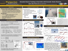
Acoustic Source Tracking in the Arctic with Acoustic Vector Sensors
In the Arctic realm, it is of interest to sense the position, speed, and trajectory of various acoustic sources. These sources may be natural (e.g. wildlife, seismic, or glacial movements) or manmade (e.g. anthropogenic traffic such as civilian, industrial, or military movements). Acoustic vector sensors (AVS) provide a means to estimate direction of arrival (DOA) of acoustic sources of interest without large sensor arrays. AVS provide a platform to measure acoustic intensity - the product of pressure and particle velocity which contains the magnitude and direction to an acoustic sound source. By combining two or more AVS, the source position can be localized. The common types of AVS that have been researched include pressure-particle velocity (pu), pressure-particle acceleration (pa), pressure-pressure (pp), and particle velocity-particle velocity (uu). Of these types, pp and pa AVS are by far the most prevalent because they utilize common equipment such as microphones, hydrophones, and accelerometers. Experiments have been conducted in Barrow, AK and other Arctic environments with underwater pa AVS to track acoustic sources in real-world environments with various frequency content and signal to noise ratio (SNR). Underwater AVS have been shown to be feasible to track underwater and on-ice sources in the Arctic.
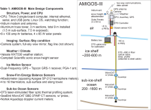
An Automated Station for Polar Ice-ocean Interaction Monitoring - AMIGOS-III
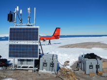
The third version of the Automated Meteorology - Ice - Geophysics - Ocean observing System (AMIGOS-III) is an autonomous multi-sensor station designed to support investigations of ice-ocean-atmosphere interactions in polar environments. It consists of a microprocessor running a simplified Linux operating system, with weather, GPS, accumulation, and surface melt, and includes a set of ocean and ice measurement sensors (CTD, doppler current flow, and DTS thermal profiler). Two stations were installed on the Thwaites Eastern Ice Shelf in January 2020 and are transmitting data as of this writing. We will present the fundamental design and review what the data show so far.
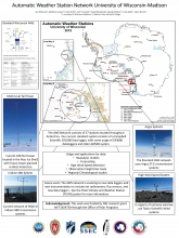
Automatic Weather Station Network University of Wisconsin-Madison
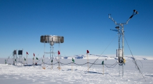
The University of Wisconsin has overseen the Antarctic Automatic Weather Station (AWS) network since 1980. In order to maintain such a network, it is necessary to deploy scientists from our group, as well as collaborating groups when appropriate, every austral summer. In the years since the last Polar Technology Conference the AWS network has updated to include newer transmission systems, and has begun the development of a new data loggers. The most recent field season focused on the installation of new Polar Climate and Weather Station, and maintenance of the existing network by Lee Welhouse, Josh Thorsland, and Taylor Norton. The history and current state of the network, instrumentation in use, and data available from the network will be presented.
Cryoegg: Development and Field Trials of a Wireless Subglacial Probe for Deep, Fast-moving Ice
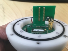
Innovative technological solutions are required to access and observe subglacial hydrological systems beneath glaciers and ice sheets. Wireless sensing systems can be used to collect and return data without the risk of losing data from cable breakage, which is a major obstacle when studying fast flowing glaciers and other high-strain environments.
We report experimental results from Cryoegg: a spherical probe that can be deployed along an ice borehole and either remain fixed in place or potentially travel through the subglacial hydrological system. The probe makes measurements in-situ and sends them back to the surface via a wireless link. Cryoegg uses very high frequency (VHF) radio to transmit data through up to 1.3 km of cold ice to a surface receiving array. It measures temperature, pressure and electrical conductivity, returning all data in real time. Field trials were conducted in 2019 at two locations in Greenland and on the Rhone Glacier in Switzerland. Our results from the field demonstrate Cryoegg’s utility in studying englacial channels and moulins, including estimating moulin discharge through salt dilution gauging with the instrument deployed deep within the moulin. Future iterations of the radio system will allow Cryoegg to transmit through up to 2.5 km of ice.
First Observations From a Video In-situ Snowfall Sensor (VISSS) Deployed During the MOSAiC Campaign
Snow is an essential component of the climate system impacting surface albedo, glaciers, sea ice, freshwater storage, and cloud lifetime. Even though we do not know the exact pathways through which ice, liquid, cloud dynamics, and aerosols are interacting in clouds while forming snowfall, the involved processes can be identified by their fingerprints on snow particles. In order to exploit these unique fingerprints of cloud microphysical processes, optical observations are required. Therefore we developed the Video In Situ Snowfall Sensor (VISSS) for high-quality in situ observations of individual snowfall particle properties. The VISSS consists of two cameras that observe falling snowfall particles with a resolution of 0.06 mm/pixel. For improved data quality, we use telecentric lenses that focus the light rays in parallel so that, unlike for normal lenses, an
object has always the same size – independent of the distance. The VISSS has been deployed during the Multidisciplinary drifting Observatory for the Study of Arctic Climate (MOSAiC http://www.mosaicobservatory.org) campaign in October 2019 where the research vessel (RV) Polarstern is spending an entire year drifting in sea ice. Here, we show first preliminary observations from the campaign.
Ice911- Restoring Arctic Albedo Through Rebuilding Ice Reflectivity in the Arctic
Ice911 is evaluating the potential use of reflective, environmentally benign materials such as HGMs in strategic areas to restore Arctic ice and reduce the Ice-Albedo Feedback Effect.
We will summarize highlights from our previous field testing, and will describe our upcoming sea ice deployment at SERF’s test pools. We’ll discuss instrumentation challenges and approaches, and possible sites for further field testing.
We’ll summarize the climate modeling approach of considering strategic areas (<1% of Arctic sea ice area) for limited deployments of this method. We’ll describe our upcoming climate modeling workshop to be held in California and online, March 13, whose aim is to help as we and our expert climate modeling partners at Climformatics, actively seek inputs and collaborations for accelerating the modeling evaluations of local and global effects to be expected from possible applications of albedo-enhancing materials to various strategic locations of Arctic sea ice.
Arctic ice restoration work has the potential to be a large and safe lever that could be practically and effectively deployed within the short term to reverse the deleterious impacts resulting from lost Arctic reflectivity, giving the world the time needed to complete the urgently needed transition to a decarbonized economy and atmosphere.
POLENET-ANET: Ongoing Development of Autonomous GNSS Systems in Antarctica
Since 2008 the POLENET-ANET project has deployed a network of autonomous, continuously-operating GPS systems that span the margin of the East Antarctic craton in the Transantarctic Mountains and across West Antarctica. The GPS time series defines the horizontal and vertical bedrock crustal motion velocity fields at mm level across the region. In the 2018-2019 austral summer season, we redesigned components of our system, including significantly lowering power requirements using a receiver integrating GNSS and Iridium communications; and developing a new antenna monument designed for stability in friable volcanic rock. The Antarctic environment presents many challenges to year-round measurement systems. Here we focus on issues arising in chokering antennas related to high winds, external rime icing, and internal ice intrusion from spin drift; as well as issues with metpack failure apparently related to static charge from blowing snow. We will present technical successes, mitigation efforts, and ongoing challenges and seek new solutions from the polar technology community.
Recent Emergence of Unmanned Aerial Vehicles for Cryosphere Research
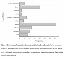
Unmanned Aerial Vehicles (UAVs) have emerged as a viable and inexpensive option for studying cryospheric components at unprecedented spatiotemporal resolutions. UAVs are adaptable to various cryospheric research needs in terms of providing flexibility with data acquisition windows, revisits, data/sensor types (multispectral, hyperspectral, microwave, thermal/night imaging, Light Detection and Ranging (LiDAR), and photogrammetric stereos), viewing angles, flying altitudes, and overlap dimensions. Thus, UAVs have the potential to act as a bridging remote sensing platform between spatially discrete in situ observations and spatially continuous but coarser and costlier spaceborne or conventional airborne remote sensing. In recent years, a growing number of studies using UAVs for cryospheric research have been published. This paper reviewed 102 studies that incorporated UAVs in cryosphere applications between 2015 and 2019. Our aim is to summarize efforts and promote successful continued incorporations of UAV-collected data for polar investigations.
Remote and Autonomous Measurements of Precipitation in Antarctica
Year-round measurements of precipitation were made at four locations on the Ross Ice Shelf in Antarctica from November 2017 to November 2019. The measurements were made with a low-power, autonomous Antarctic Precipitation Systems (APSs) as a part of the United States Antarctic Program (USAP). The precipitation was measured using an Ott Pluvio2 weighing precipitation gauge installed inside a double Alter wind shield. Additional observations, such as snow height, wind speed, particle counts, and videos, are included with the APS sites to provide supplemental measurements. The goals of the project are to develop the ability to measure precipitation in Antarctica and further evaluate the surface mass balance as well as to assess numerical weather prediction and climate model precipitation estimates. This presentation will provide an overview of the precipitation measurement systems, challenges and lessons learned from the two year deployment of the instruments, and thoughts on modifications for improved results in a potential future redeployment of the APSs in Antarctica.
Soil Moisture Retrievals by Ecosystem Type Using In-situ Logger Networks and Satellite Data in High Northern Latitudes
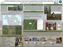
In-situ field sensors have been used to measure soil moisture in the Arctic Tundra and boreal peatlands for calibration and validation of satellite soil moisture retrieval algorithms in northern environments. Sensors have bene installed to characterize spatial and temporal radiometric diversity in imaging radar backscatter (σο) by land cover type within three satellite Soil Moisture Active Passive (SMAP) grid cells. Using the senor data and a suite of ancillary field data, including vegetation species composition and biomass, soil moisture retrieval algorithms are being developed for Sentinel-1/Radarsat-2 and/or ALOS-PALSAR-2 for the organic soils of each ecosystem type. Soil moisture loggers communicate through the iridium satellite network. Data are relayed once per day during the summer growing season, and hourly data are stored onboard and downloaded annually. Real time data are available through a web interface that presents interactive time series plots of the data in addition to site location and metadata information. Logger data have been calibrated using harvested in-situ soil samples. Organic soils found across high northern latitudes have a characteristic low bulk density and the default loam calibration inherent in off-the-shelf sensors typically underestimates actual soil moisture condition.
The Development of the Polar Climate Weather Station (PCWS) System
The PCWS is a student-developed embedded weather & climate observation system based on 8-bit CMOS microprocessor technology. The system has been designed with the goal to operate in the extreme weather conditions of polar climates. Through years of revisions, the team at Madison College has made significant progress in the PCWS systems hardware & software implementation. The PCWS system employs 24-bit analog-to-digital conversion technology, paired with instrumentation amplifiers, ensuring analog sensor precision. At the systems heart, a temperature-compensated-crystal-oscillator provides accurate timing & the ability to capture accurate frequency measurements in frigid environments. On January 14th, 2020, the team successfully installed the first working and transmitting PCWS at Sarah site near the University of Wisconsin-Madison Willie Automatic Weather Station (AWS) near Williams Airfield, Antarctica. Successful platinum resistance thermometer & thermistor temperatures, relative humidity, wind speed & direction values were recorded. In future field seasons, additional installations of the PCWS will be compared against existing Antarctic AWS technology. The team will continue to develop a final revision of the PCWS through the end of this summer. Future goals are to improve power system efficiency, conduct more comprehensive testing, and expand the software capabilities of the PCWS.
USCGC Healy
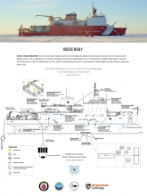
USCGC Healy is the United States' largest and most technologically advanced icebreaker as well as the US Coast Guard's largest vessel. She is classified as a medium icebreaker by the U.S. Coast Guard. She is homeported in Seattle, Washington and was commissioned in 1999. On September 5, 2015, USCGC Healy became the first unaccompanied United States surface vessel to reach the North Pole.
She is a capable and modular platform that can host dozens of scientists and specialized equipment; and the only platform of its kind to collect meaningful physical oceanographic data in the Arctic when encountering more than 5' of ice.
Communications
Iridium for the Polar Environment: Exploration of Current and Future Technology
An Overview of Current Iridium Techniques employed in the Polar environment for RUDICS and SBD, including a review of the successes, limitations, and failures of said techniques. This includes a review of using an IP tunnel with Iridium RUDICS and methods for maximizing the effective bandwidth of RUDICS connections. Specific examples of real-world issues are included.
Additionally, an overview of potential applications of Iridium Certus using the upcoming 9770 modem are explored. Potential Bandwidth and Power Consumptions discussed and compared with the current state of the art with respect to their applicability in the Polar Science community. Benefits and downsides of sensors with integrated modems vs an external telemetry device are explored to enable discussion within the community.
Long Range VHF Data Communications with Wize
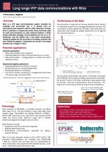
Wize (https://www.wize-alliance.com/) is a wireless communication standard that operates in the VHF band, at 169MHz. This low frequency gives it excellent range and deep penetration into buildings. Wize derives from technology used for utility metering in Europe, and is licence-free to operate in Europe. The radio modems are inexpensive and readily available from a number of manufacturers. This presentation will give an overview of its capabilities and potential uses in polar research - for science, logistics and facilities management applications.
Data Access and Sharing
Arctic HF Network Planning Tool
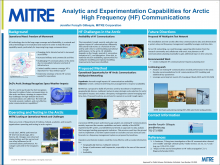
Arctic communication capability is inadequate due to satellite coverage deficiency, lack of infrastructure, immensity of the arctic, and challenging ionospheric behavior. There is a need to effectively predict optimal High Frequency (HF) communications paths around the aroural oval to establish accurate requirements, evaluate operational scenarios, and create investment strategies for new technologies and CONOPs to achieve fully networked C3 for a robust and resilient infrastructure. MITRE is developing a modeling tool that will take in a network of HF system locations, map the width of the ionospheric trough given conditions, and find the optimal HF communications path. The tool could be used for operational planning including spectrum selection and planning future infrastructure configurations and CONOPs. This is valuable to sponsors across the Air Force and DoD to research capability for a denied or degraded communications environment and provide a tool to inform operational planning and enable accurate requirements and investment strategies as the arctic continues to become more accessible.
Data at the Edge: Providing Data Resources and Analytic Capabilities in Communication-Limited Environments
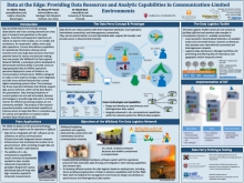
Data and information from remote sensing observations and in-situ sensing networks are a key part of research and operations in polar regions. Scientists and equipment operators rely on data for their studies, running models and simulations, researchers’ safety, and planning daily operations. Current capabilities for operational information sharing cannot transmit some very large data resources that have potential value for science and decision-making. Here we present the Wildland Fire Data Logistics Network (WDLN), a prototype system developed to provide large geospatial data access to wildfire operations personnel deployed in areas of limited or no communications infrastructure. WDLN is designed to provide network access geared for user communities that require prioritization of data and access that is resilient to changes in network nodes.This prototype has three important attributes that directly support data access resilience, which will be described in this presentation. Data sharing limitations of current systems are not well articulated, because technologies to provide large data sets in a timely manner for efficient analysis processing are not commonly available. The research product presented provides a demonstrated capability to improve access to large data files in a seamless way for science and operations in locations where standard data infrastructure fails.
Overarching and Integrative Technology
Development of a Decision Support Tool to Aid Iceberg Management Operations
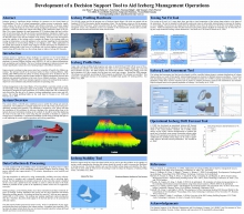
Icebergs present a significant design challenge for operators on the Grand Banks of Newfoundland. The use of iceberg management, iceberg towing in particular, significantly reduces the risk of iceberg impacts with offshore structures. A decision support system is being developed to assist with iceberg management operations. Iceberg management is currently carried out without knowledge of the underwater shape of the iceberg. The system integrates the rapid generation of 3D iceberg shape data and a collection of tools that utilize the data to provide recommendations, intended to improve iceberg management effectiveness. An interface has been developed to de-noise the collected data and correct it for drift and rotation of the iceberg. Tools have been developed to assess the stability of the iceberg, and to consider the shape of the iceberg relative to towing net dimensions, to provide guidance to the operator regarding the recommended towing direction to avoid iceberg rolling or net slippage events. Other applications of the profile data include an impact loads analysis tool that determines the distribution of potential iceberg loads in the event of a collision with a given platform, and an operational iceberg drift model that uses the iceberg shape to improve iceberg drift forecasts.
Erebus Backbone Network Overview: Geophysical Stations Fortified for a High-Altitude Polar Volcanic Environment
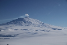
The Polar Team of the IRIS/PASSCAL Instrument Center at New Mexico Tech is developing integrated seismic and infrasound stations to be deployed as the long-term Erebus Backbone Network around the summit of Mt. Erebus in Antarctica. Mt. Erebus is the southernmost active volcano in the world, located approximately 20 miles from McMurdo Station.
The high-elevation volcanic environment of Mt. Erebus poses particular design challenges in addition to those characteristic of all polar regions. Design parameters not only account for extreme cold temperatures, strong winds, and dark winters, but also for projectile volcanic rock and corrosive gases. Lightweight modular components will also be integrated where feasible.
Each station will be comprised of two data loggers operating 365/24/7; one will record broadband and strong-motion seismic data, and the other will record infrasound data. These data will provide a baseline for detecting trends in volcanic activity, and will be useful as a reference for future studies. State-of-health metrics and low sample rate seismic data will be transmitted near real-time via Iridium telemetry. The complete dataset will be collected by PASSCAL Engineers on service visits to each station. These data will be archived and publicly available at the IRIS Data Management Center.
NSF Iridium Program Overview with Focus on Satellite Data-transmission
Long-range communication requirements are difficult to satisfy at high latitudes. Iridium satellite service offers global voice and data coverage that can satisfy needs related to field safety, logistics support, educational outreach, science data transfer, telemetry monitoring, and remote command and control. The United States Antarctic Program (USAP) has an established process through which any National Science Foundation (NSF) grantee or collaboration partner can access Iridium services and support resources. This presentation will provide an overview of what services and technologies are and are not currently supported, what new technologies and capabilities are on the horizon, and instructions on how the program can be accessed.
Operational River Ice Monitoring: From Earth-observation Satellite Imagery to In-situ Measurements
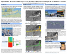
Many northern rivers that develop ice cover during the winter are prone to ice-related flooding which can impact communities. In order to assess flood risk and mitigate its impact, it is imperative to monitor the ice cover throughout the season, with emphasis on the freeze-up and break-up periods. Operational monitoring is being undertaken on the Churchill River in Labrador, Canada.
Imagery from earth-observation satellites are used to generate frequent (1-5 days) ice-cover, ice-classification, and change-detection products and are made available to the public through a government website. A helicopter mounted ice-penetrating radar (IPR) system has been developed to provide maps of ice-thickness data. The helicopter IPR is effective for producing tracks (O(10) km) of ice-thickness data in short time-periods (~1 hr). It is especially valuable for obtaining data over the locations were potentially thin river ice cannot support manual data-collection. IPR becomes ineffective once water is present in or on the ice. To augment the IPR data, four recoverable sea-ice thickness buoys have been modified and installed (from helicopter) to provide, through the Iridium data network, frequent (~6 hrs) in-situ measurements from which the ice temperature and thickness can be derived and delivered in near real time.
Using Science to Improve Winter Logistics
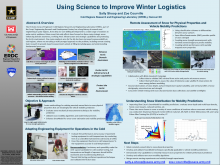
The US Army Corps of Engineers' Cold Regions Research and Engineering Laboratory (CRREL), part of the Corps' Engineering Research and Development Center, has a long history of research and engineering in polar regions, from deep ice core drilling development to a wide range of solutions to polar-centric problems. More recent lab-wide efforts have focused on three main strategic areas: enhancing domain awareness, evolving Arctic infrastructure and strategic capabilities and protecting the Arctic environment. One main emphasis area for the lab has been increased maneuverability in cold regions, where we are taking a multi-pronged approach to the problem, including remote sensing basic research to ground-based measurements aimed at filling knowledge gaps and understanding fundamental processes.

